- “Multirotor UAV in project 14.B37.21.1243” Vyacheslav Barbasov, Pavel Orlov

Содержание
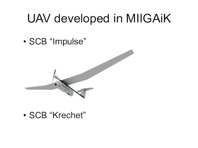
- 2. UAV developed in MIIGAiK SCB “Impulse” SCB “Krechet”
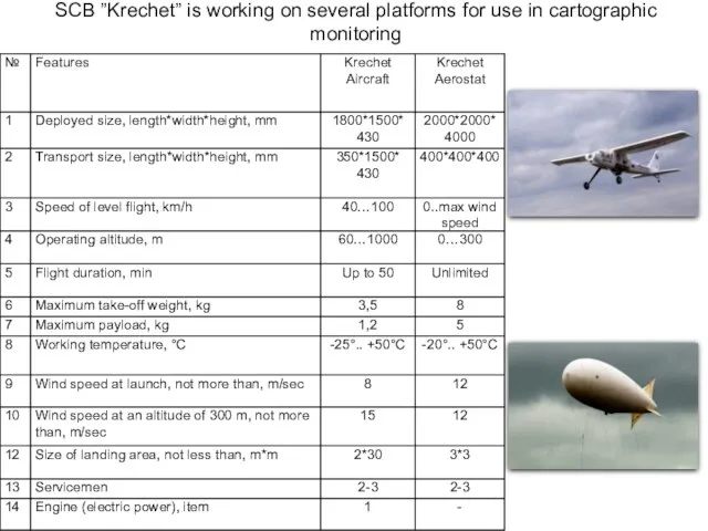
- 3. SCB ”Krechet” is working on several platforms for use in cartographic monitoring
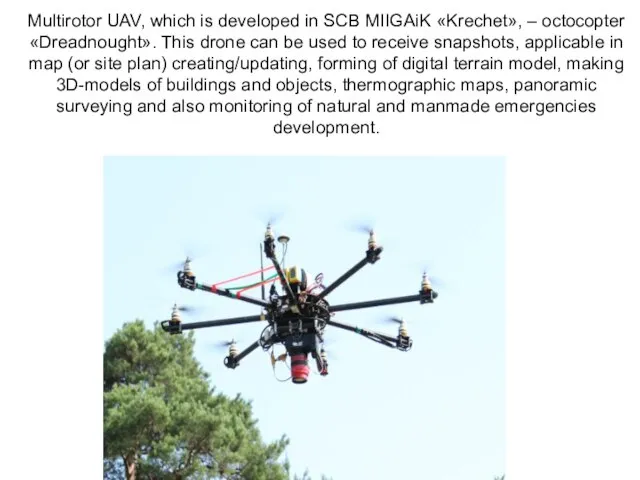
- 5. Multirotor UAV, which is developed in SCB MIIGAiK «Krechet», – octocopter «Dreadnought». This drone can be
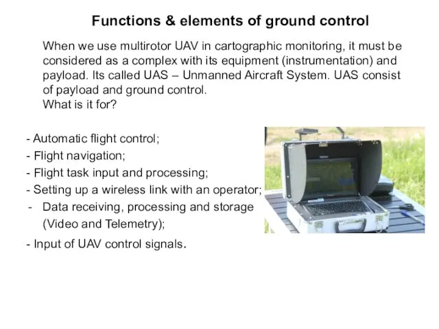
- 6. Functions & elements of ground control When we use multirotor UAV in cartographic monitoring, it must
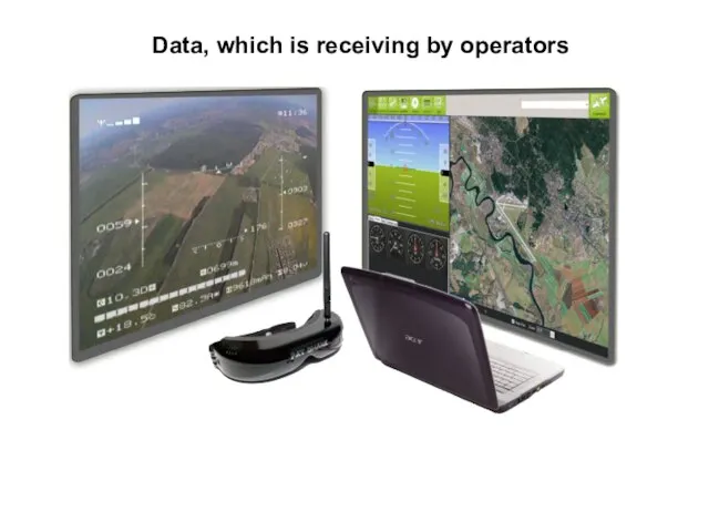
- 7. Data, which is receiving by operators
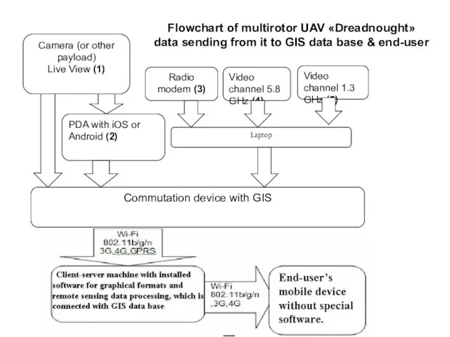
- 8. Flowchart of multirotor UAV «Dreadnought» data sending from it to GIS data base & end-user
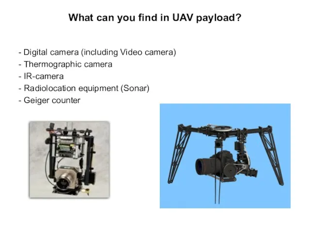
- 9. What can you find in UAV payload? - Digital camera (including Video camera) - Thermographic camera
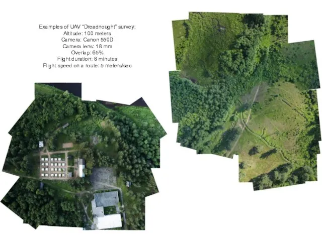
- 10. Examples of UAV “Dreadnought” survey: Altitude: 100 meters Camera: Canon 550D Camera lens: 18 mm Overlap:
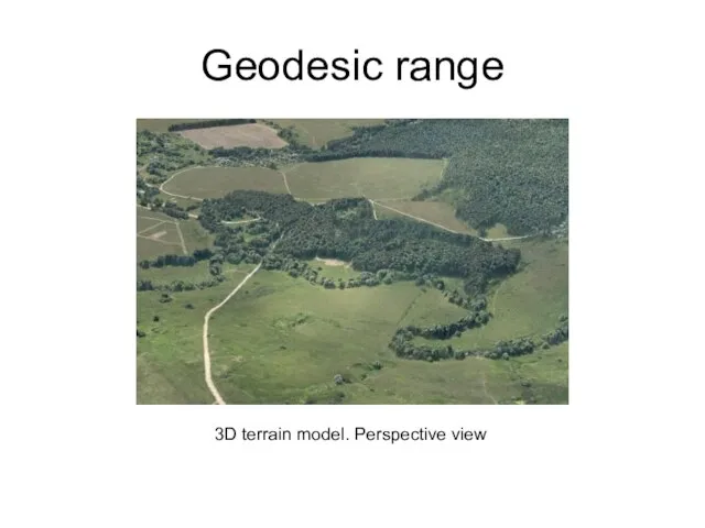
- 11. Geodesic range 3D terrain model. Perspective view
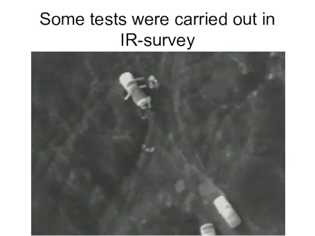
- 12. Some tests were carried out in IR-survey
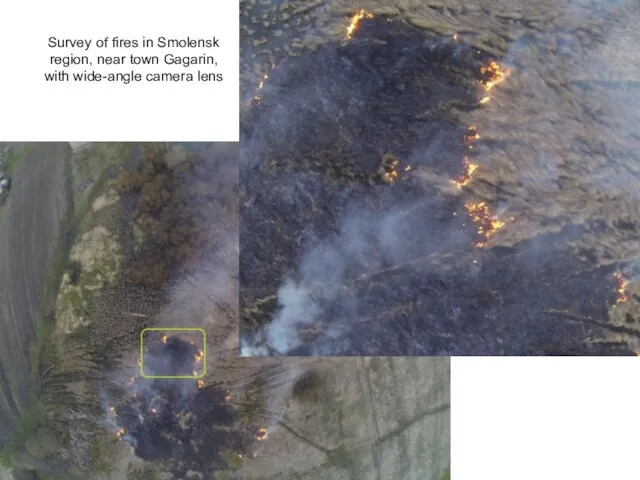
- 13. Survey of fires in Smolensk region, near town Gagarin, with wide-angle camera lens
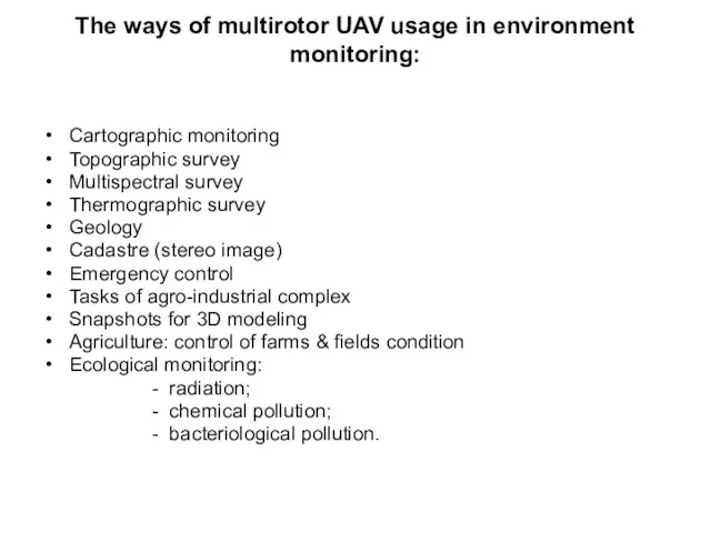
- 14. The ways of multirotor UAV usage in environment monitoring: Cartographic monitoring Topographic survey Multispectral survey Thermographic
- 16. Скачать презентацию
Слайд 3SCB ”Krechet” is working on several platforms for use in cartographic monitoring
SCB ”Krechet” is working on several platforms for use in cartographic monitoring
Слайд 5Multirotor UAV, which is developed in SCB MIIGAiK «Krechet», – octocopter «Dreadnought». This
Multirotor UAV, which is developed in SCB MIIGAiK «Krechet», – octocopter «Dreadnought». This
Слайд 6Functions & elements of ground control
When we use multirotor UAV in
Functions & elements of ground control
When we use multirotor UAV in
Слайд 7Data, which is receiving by operators
Data, which is receiving by operators
Слайд 8Flowchart of multirotor UAV «Dreadnought»
data sending from it to GIS data
Flowchart of multirotor UAV «Dreadnought» data sending from it to GIS data
Слайд 9What can you find in UAV payload?
- Digital camera (including Video camera)
-
What can you find in UAV payload?
- Digital camera (including Video camera)
-
Слайд 10Examples of UAV “Dreadnought” survey:
Altitude: 100 meters
Camera: Canon 550D
Camera lens: 18 mm
Overlap:
Examples of UAV “Dreadnought” survey: Altitude: 100 meters Camera: Canon 550D Camera lens: 18 mm Overlap:
Слайд 11Geodesic range
3D terrain model. Perspective view
Geodesic range
3D terrain model. Perspective view
Слайд 12Some tests were carried out in IR-survey
Some tests were carried out in IR-survey
Слайд 13Survey of fires in Smolensk region, near town Gagarin,
with wide-angle camera
Survey of fires in Smolensk region, near town Gagarin, with wide-angle camera
Слайд 14The ways of multirotor UAV usage in environment monitoring:
Cartographic monitoring
Topographic survey
Multispectral survey
Thermographic
The ways of multirotor UAV usage in environment monitoring:
Cartographic monitoring
Topographic survey
Multispectral survey
Thermographic
 Презентация на тему Технология изготовления изделий, вязанных крючком и спицами
  Подготовила учитель начальных классов МБОУ СОШ №6 города Киржач Макарова Светлана Витальевна
 Что такое КАНЗАШИ? История, виды.
 Социальная терапия
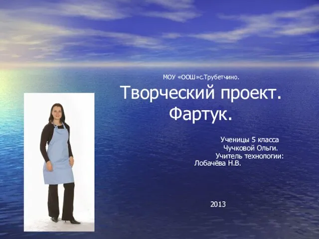 Презентация на тему Творческий проект "Фартук"
  Учимся рисовать бурого медведя - презентация к уроку Технологии_
 Презентация на тему Обрывная аппликация из бумаги на бумажной основе
  Виды рукоделия! Рукоделие — любимое хобби многих женщин и иногда даже мужчин. В наше время очень много видов рукоделия: вышивание
 Презентация на тему Воздушный змей
  Вышивание гладью - презентация к уроку Технологии_
 Творческий проект Картина «Нежность» Работа учащейся 9 А класса МОУ гимназии №30 г. Ставрополя Бровковой Александры Руководит
 Презентация на тему Вышивка крестом. Методы и виды вышивки крестом. Болгарский крест
  Презентация на тему Секреты пластилина. Петушок
 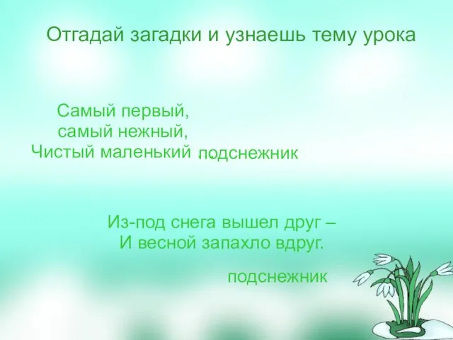 Самый первый, самый нежный, Чистый маленький … Из-под снега вышел друг – И весной запахло вдруг.
 Презентация на тему Работа с глиной. Керамика
  Презентация на тему Вязание
  Презентация на тему Бутерброды
 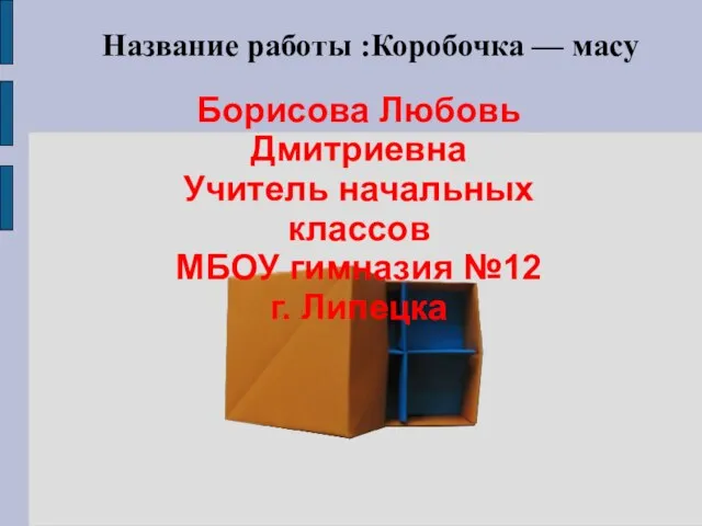 Название работы :Коробочка — масу
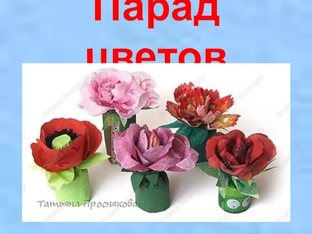 Презентация на тему: Парад цветов
 ООО «ЦРНА ГОРА ИНЖЕНЕНРИНГ» 119121, г.Москва, Ружейный переулок, д.3 тел.: (495) 755-50-48, факс: (495) 755-50-48 E-mail crna@mail.ru, сайт: http://crnagora-e.ru
 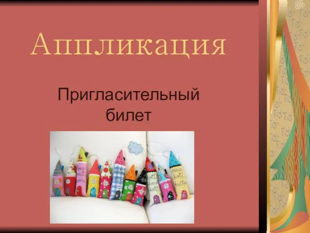 Аппликация Пригласительный билет
 Ручные строчки и машинные швы - презентация к уроку Технологии_
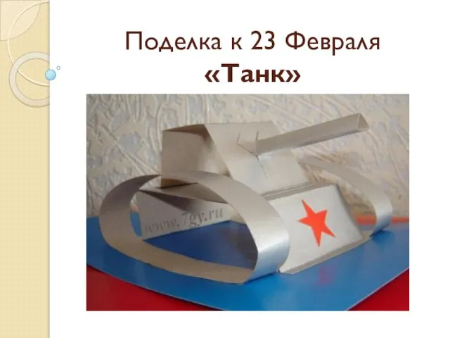 Презентация на тему Поделка ко Дню защитника Отечества "ТАНК"
  Аппликация с сердечками Презентацию подготовила учитель: Шарапова В.М. 2009 год г. Москва
 Современные тенденции развития марийской национальной кухни - презентация к уроку Технологии
 Новогодний снеговик - презентация к уроку Технологии_
 Презентация на тему: Подарок маме 1 класс
 Буквы из пенопласта Не дурно смотрится какой-нибудь афоризм, умное высказывание на передней стенке предметного кабинета. Доступн