- Unit 9. Theme: geographical location and boundaries

Содержание
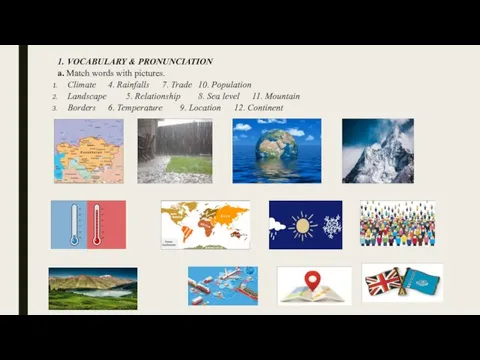
- 2. 1. VOCABULARY & PRONUNCIATION a. Match words with pictures. Climate 4. Rainfalls 7. Trade 10. Population
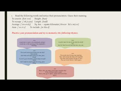
- 3. Read the following words and notice their pronunciation. Guess their meaning. To consist [kənˈsɪst] Height [haɪt]
- 4. 2. READING & SPEAKING a. Pre-reading task: before you read the text, try to answer these
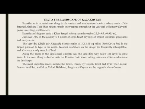
- 5. TEXT A THE LANDSCAPE OF KAZAKHSTAN Kazakhstan is mountainous along its far eastern and southeastern borders,
- 6. TEXT B THE CLIMATE OF KAZAKHSTAN The territory of Kazakhstan stretches for more than 3000 km
- 7. TEXT C GEOGRAPHICAL SITUATION OF KAZAKHSTAN Kazakhstan is located in Central Asia and Eastern Europe at
- 8. TEXT D THE GEOGRAPHY OF GREAT BRITAIN To the west of the continent of Europe there
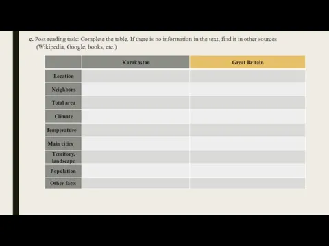
- 9. c. Post reading task: Complete the table. If there is no information in the text, find
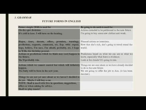
- 10. 3. GRAMMAR FUTURE FORMS IN ENGLISH
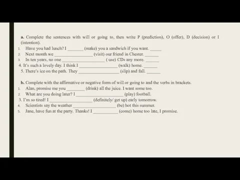
- 11. a. Complete the sentences with will or going to, then write P (prediction), O (offer), D
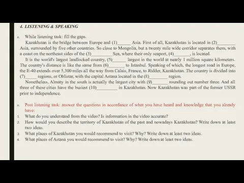
- 12. 4. LISTENING & SPEAKING While listening task: fill the gaps. Kazakhstan is the bridge between Europe
- 14. Скачать презентацию
Слайд 3Read the following words and notice their pronunciation. Guess their meaning.
To
Read the following words and notice their pronunciation. Guess their meaning.
To
Слайд 42. READING & SPEAKING
a. Pre-reading task: before you read the text,
2. READING & SPEAKING
a. Pre-reading task: before you read the text,
Слайд 5TEXT A THE LANDSCAPE OF KAZAKHSTAN
Kazakhstan is mountainous along its far
TEXT A THE LANDSCAPE OF KAZAKHSTAN
Kazakhstan is mountainous along its far
Слайд 6TEXT B THE CLIMATE OF KAZAKHSTAN
The territory of Kazakhstan stretches for
TEXT B THE CLIMATE OF KAZAKHSTAN
The territory of Kazakhstan stretches for
Слайд 7TEXT C GEOGRAPHICAL SITUATION OF KAZAKHSTAN
Kazakhstan is located in Central Asia
TEXT C GEOGRAPHICAL SITUATION OF KAZAKHSTAN
Kazakhstan is located in Central Asia
Слайд 8TEXT D THE GEOGRAPHY OF GREAT BRITAIN
To the west of the
TEXT D THE GEOGRAPHY OF GREAT BRITAIN
To the west of the
Слайд 9c. Post reading task: Complete the table. If there is no information
c. Post reading task: Complete the table. If there is no information
Слайд 103. GRAMMAR
FUTURE FORMS IN ENGLISH
3. GRAMMAR
FUTURE FORMS IN ENGLISH
Слайд 11a. Complete the sentences with will or going to, then write P
a. Complete the sentences with will or going to, then write P
Слайд 124. LISTENING & SPEAKING
While listening task: fill the gaps.
Kazakhstan is
4. LISTENING & SPEAKING
While listening task: fill the gaps.
Kazakhstan is
 Name the heroes
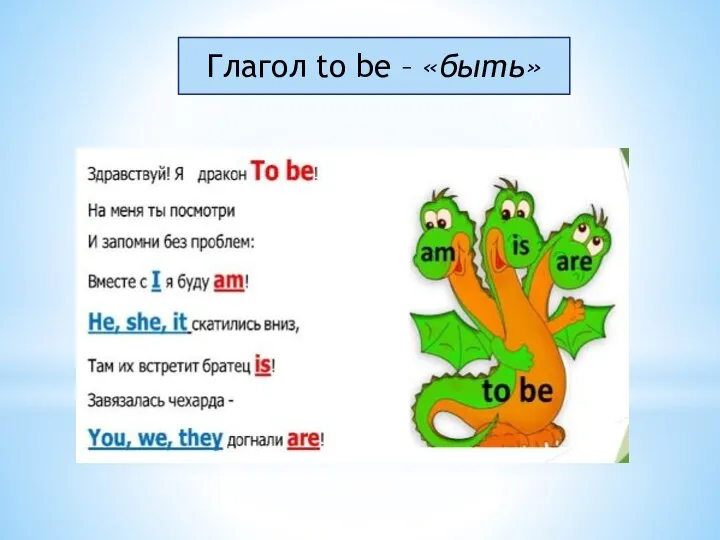 Глагол to be (быть)
 Gerund versus infinitive
 Subject matter of elt
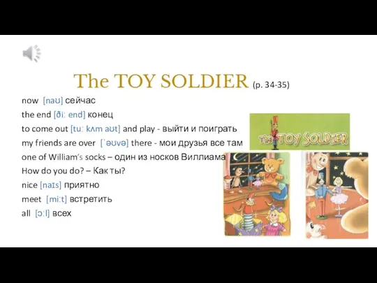 The toy soldier (p. 34-35)
 Interpret Charts
 Attributed to smb
 Health Unit 8
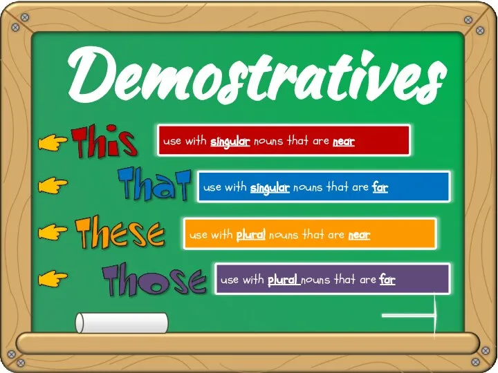 Demonstratives
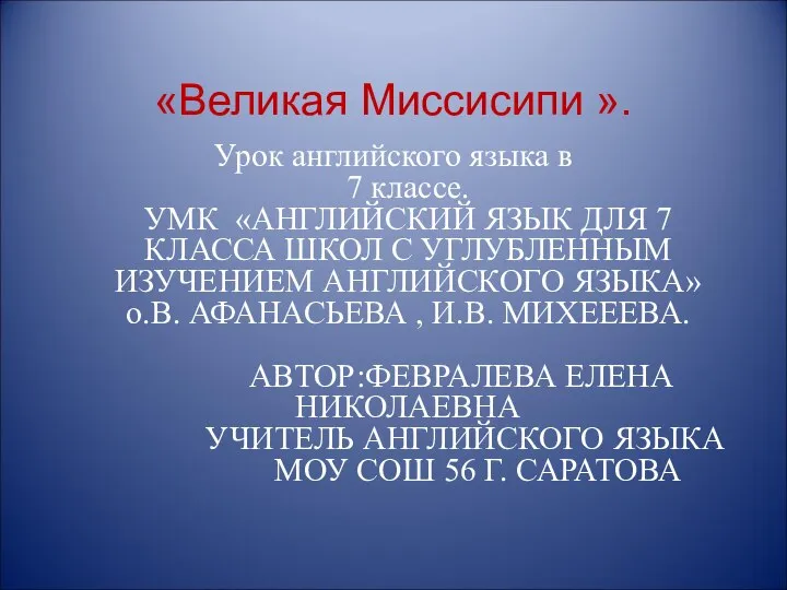 The Great Mississippi
 Образование множественного числа существительных
 Структурные трансформации при переводе
 English-speaking countries. Внеклассное мероприятие, КВН
 Teddy bear
 Have a Great Day
 Конкурс перевода поэзии. Английский язык
 Come and play
 Human nature
 Countable and uncountable nouns
 Story of the little mouse
 How to write a Curriculum Vitae
 Invention of the first Fruit Ice
 Презентация на тему THE WEATHER
  Compound adjectives
 Self Control by Bebe Rexha
 Group 4001
 Types of homes
 To be
To be