Содержание
- 2. “Project 14.B37.21.1243” WGL-EGL Joint Tech Meeting, September 19-21, 2013 “Research and development of the opened networked
- 3. “Project 14.B37.21.1243” WGL-EGL Joint Tech Meeting, September 19-21, 2013 Moscow State University of Geodesy and Cartography
- 4. “Project 14.B37.21.1243” Moscow State University of Geodesy and Cartography (MIIGAiK) Town Alatyr, Chuvashia region Yandex maps
- 5. Town Tikhvin (near Saint-Petersburg) EROS-B (21 April 2013) Yandex maps (geoportal) “Project 14.B37.21.1243” Moscow State University
- 6. Settlement Korostovo EROS B (2 May 2013) Kosmosnimki.ru (geoportal) “Project 14.B37.21.1243” Moscow State University of Geodesy
- 7. “Multi rotary UAV in Project 14.B37.21.1243” WGL-EGL Joint Tech Meeting, September 19-21, 2013 Moscow State University
- 8. unmanned aircraft «PTERRO» with camera CANON Tests on the MIIGAiKs geodesic test area UAV developed in
- 9. UAV developed in MIIGAiK: SCB “Krechet”
- 11. Multirotor UAV, which is developed in SCB MIIGAiK «Krechet», – octocopter «Dreadnought». This drone can be
- 12. Functions & elements of ground control When we use multirotor UAV in cartographic monitoring, it must
- 13. Data, which is receiving by operators “Multi rotary UAV in Project Project 14.B37.21.1243” Moscow State University
- 14. Flowchart of multirotor UAV «Dreadnought» data sending from it to GIS data base & end-user
- 15. What can you find in UAV payload? - Digital camera (including Video camera) - Thermographic camera
- 16. Examples of UAV “Dreadnought” survey: Altitude: 100 meters Camera: Canon 550D Camera lens: 18 mm Overlap:
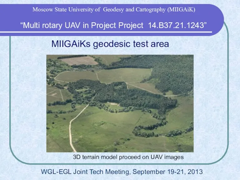
- 17. MIIGAiKs geodesic test area 3D terrain model proceed on UAV images “Multi rotary UAV in Project
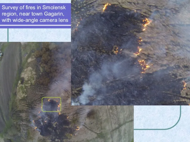
- 18. Survey of fires in Smolensk region, near town Gagarin, with wide-angle camera lens
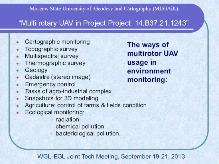
- 19. The ways of multirotor UAV usage in environment monitoring: Cartographic monitoring Topographic survey Multispectral survey Thermographic
- 20. Usage of results in studying & education Experience of UAV development, its usage and data processing
- 21. “On development of open-source portal for use of the remotely sensed data in emergency situations response
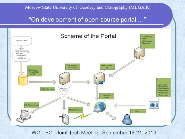
- 22. WGL-EGL Joint Tech Meeting, September 19-21, 2013 “On development of open-source portal …” Moscow State University
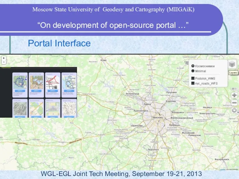
- 23. Portal Interface WGL-EGL Joint Tech Meeting, September 19-21, 2013 “On development of open-source portal …” Moscow
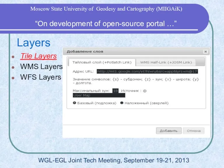
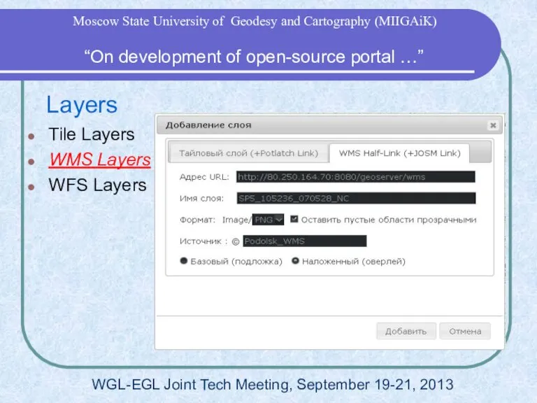
- 24. Layers Tile Layers WMS Layers WFS Layers WGL-EGL Joint Tech Meeting, September 19-21, 2013 “On development
- 25. Layers Tile Layers WMS Layers WFS Layers WGL-EGL Joint Tech Meeting, September 19-21, 2013 “On development
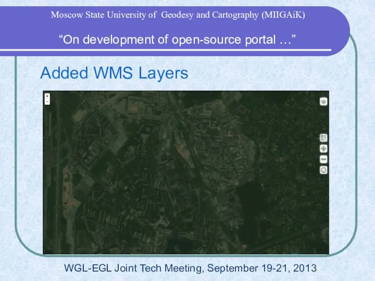
- 26. Added WMS Layers WGL-EGL Joint Tech Meeting, September 19-21, 2013 “On development of open-source portal …”
- 27. Portal on Mobile Devices Based on “Phonegap” by Cordova Could save map layers and show it
- 28. 3D Data Based on Web-GL technology Spatial Data from UAV 3D models from Photoscan WGL-EGL Joint
- 29. “On development of open-source portal …” Moscow State University of Geodesy and Cartography (MIIGAiK)
- 31. Скачать презентацию


 Соленая рыба
 Схема АПС
 Абсолютные и относительные статистические показатели
  Культура: понятие и сущность
 ИСПАРЕНИЕ ВЛАГИ ПОД ДЕЙСТВИЕМ СОЛНЦА
 МикротурбинаMTI 250
 Презентация на тему Двадцать четвёртое февраля
  Фотоальбом. От проекта до эксплуатации
 Запуск рекламы
 Презентация команды АО МНИИТЭП
 Особенности кожного покрова
 презентация сайт
 Новый человек в новых медиа
 Государственное управление в космической отрасли
 Презентация на тему Периметр и площадь прямоугольника
  Играем и читаем
 Подключение
 Индивидуальное предпринимательство
 IP-система iPOLIS Samsung
 Diagonal elements
 1
1 Тиамин
 Основные фонды предприятия
 Базовая сердечно-легочная реанимация
  Независимая оценка качества образования. Этапы формирования 1-х классов
 Использование параллелограмма в жизни
 координаты
 Регулирующая и надзорная деятельность банка России