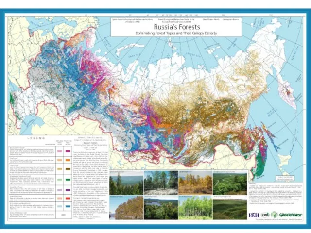
- Regional Scale Forest Mapping with Medium Resolution Satellite

Содержание
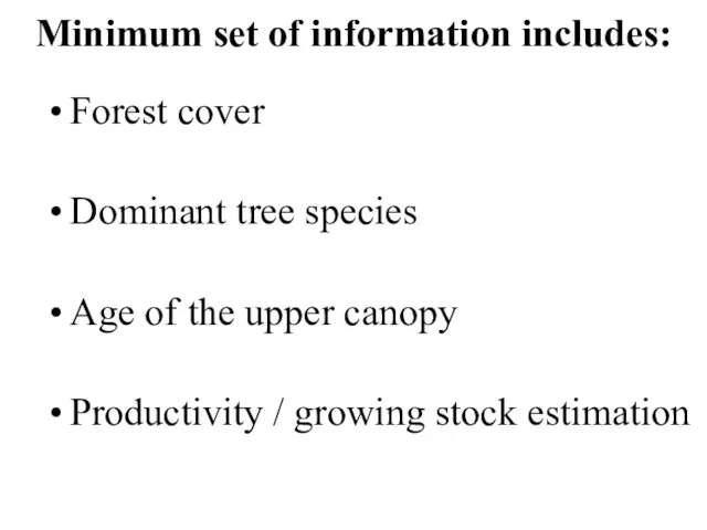
- 3. Minimum set of information includes: Forest cover Dominant tree species Age of the upper canopy Productivity
- 4. Options for the forest cover and tree species: Modis data (like UMD TreeCover) + official forest
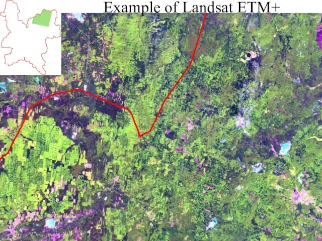
- 5. Example of Landsat ETM+
- 6. dark coniferous (spruce, fir) pine mixed deciduous – dark coniferous deciduous (birch, aspen) cleacuts fire scars
- 7. IRS-P6 AWiFS
- 8. Retrospective data allow age classification ~2000 Landsat ETM+ GLCF ~1990 Landsat TM GLCF ~1980 Landsat MSS
- 9. Landsat MSS (~1980)
- 10. Landsat TM (~1990)
- 11. Change detection MSS-TM
- 12. Landsat TM (~1990)
- 13. Landsat ETM+ (~2000)
- 14. Change TM-ETM+
- 15. Logging of 1980-2000
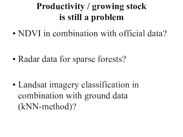
- 16. Productivity / growing stock is still a problem NDVI in combination with official data? Radar data
- 18. Kirov Oblast Mapping (2004-2006) ~2000 Landsat ETM+ GLCF ~1990 Landsat TM GLCF ~1980 Landsat MSS GLCF
- 19. European Russia Mapping (2006-2007) ~2000 Landsat ETM+ GLCF ~1990 Landsat TM GLCF ~1980 Landsat MSS GLCF
- 20. European Russia Mapping (plans for 2008) ~2000 Landsat ETM+ GLCF ~1990 Landsat TM GLCF ~1980 Landsat
- 21. Logging sustainability Planting Natural reforestation clearcuts selective logging forest fires pest outbreaks Forest resources Economically unavailable
- 22. MSS-TM-ETM+ change detection Northern Kirov Oblast
- 23. Lamdsat MSS, ~1980
- 24. Landsat TM, ~1990
- 25. Landsat ETM+, ~2000
- 26. non-forest areas clearcuts 1990 – 2000 ther forest clearcuts 1980-1990
- 27. non-forest areas clearcuts 1980 – 2000 гг. other forest
- 28. non-forest lands clearcuts 1980 – 2000 other forest old coniferous
- 30. Скачать презентацию
Слайд 3Minimum set of information includes:
Forest cover
Dominant tree species
Age of the upper canopy
Productivity
Minimum set of information includes:
Forest cover
Dominant tree species
Age of the upper canopy
Productivity
Слайд 4Options for the forest cover and tree species:
Modis data (like UMD TreeCover)
Options for the forest cover and tree species:
Modis data (like UMD TreeCover)
Слайд 5Example of Landsat ETM+
Example of Landsat ETM+
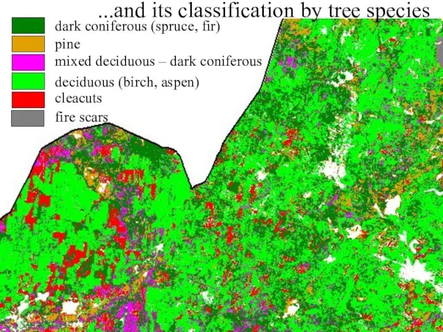
Слайд 6dark coniferous (spruce, fir)
pine
mixed deciduous – dark coniferous
deciduous (birch, aspen)
cleacuts
fire scars
...and its
dark coniferous (spruce, fir)
pine
mixed deciduous – dark coniferous
deciduous (birch, aspen)
cleacuts
fire scars
...and its
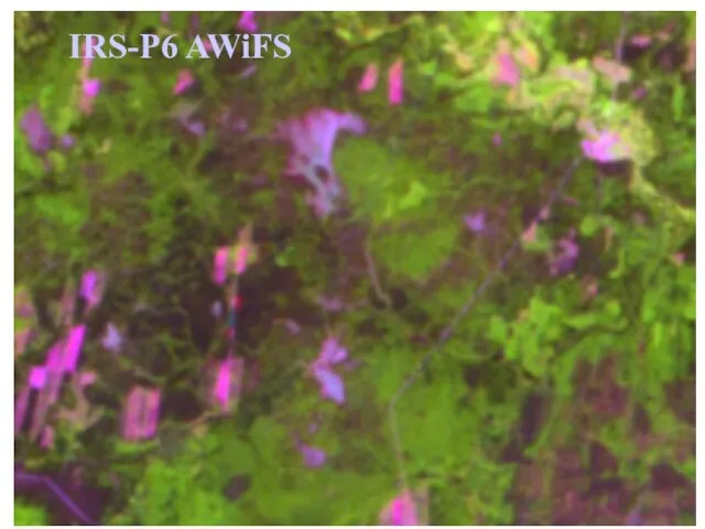
Слайд 7IRS-P6 AWiFS
IRS-P6 AWiFS
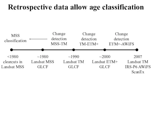
Слайд 8Retrospective data allow age classification
~2000
Landsat ETM+
GLCF
~1990
Landsat TM
GLCF
~1980
Landsat MSS
GLCF
2007
Landsat TM
IRS-P6 AWiFS
ScanEx
<1980
clearcuts in
Landsat MSS
Change
detection
MSS-TM
Change
detection
TM-ETM+
Change
detection
ETM+-AWiFS
MSS
classification
Retrospective data allow age classification
~2000
Landsat ETM+
GLCF
~1990
Landsat TM
GLCF
~1980
Landsat MSS
GLCF
2007
Landsat TM
IRS-P6 AWiFS
ScanEx
<1980
clearcuts in
Landsat MSS
Change
detection
MSS-TM
Change
detection
TM-ETM+
Change
detection
ETM+-AWiFS
MSS
classification
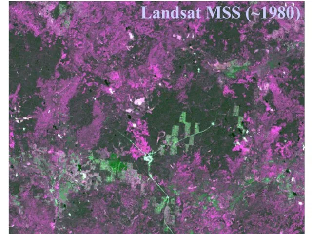
Слайд 9Landsat MSS (~1980)
Landsat MSS (~1980)
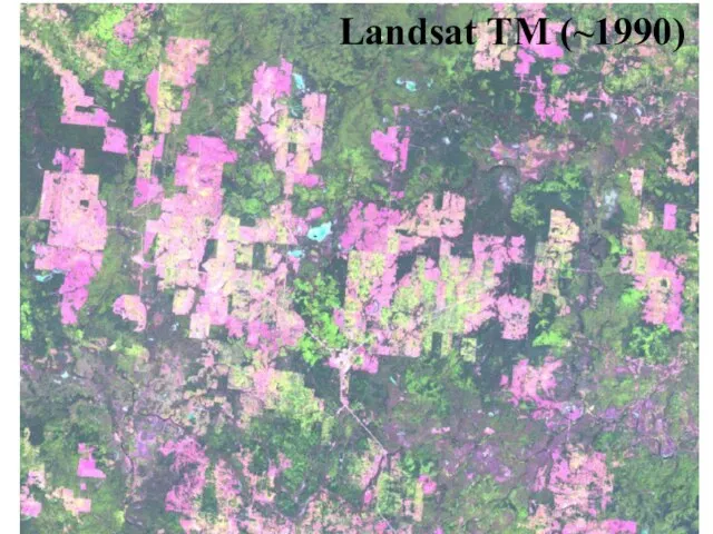
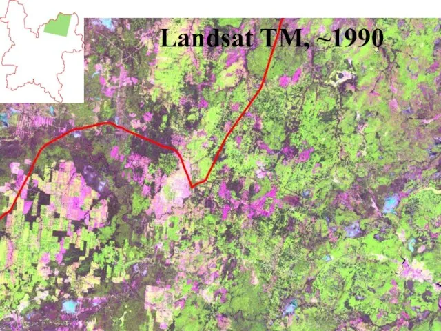
Слайд 10Landsat TM (~1990)
Landsat TM (~1990)

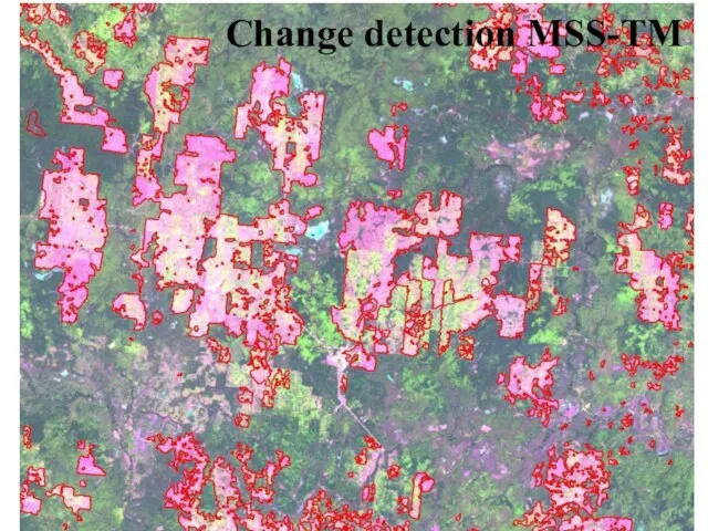
Слайд 11Change detection MSS-TM
Change detection MSS-TM
Слайд 12Landsat TM (~1990)
Landsat TM (~1990)
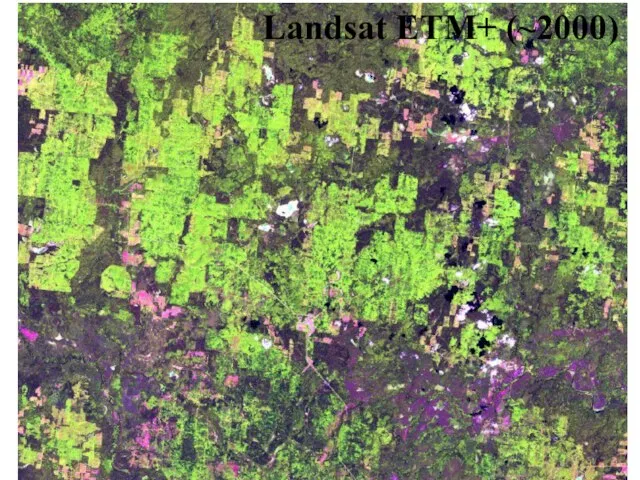
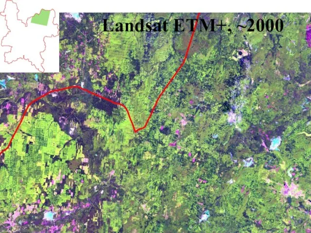
Слайд 13Landsat ETM+ (~2000)
Landsat ETM+ (~2000)
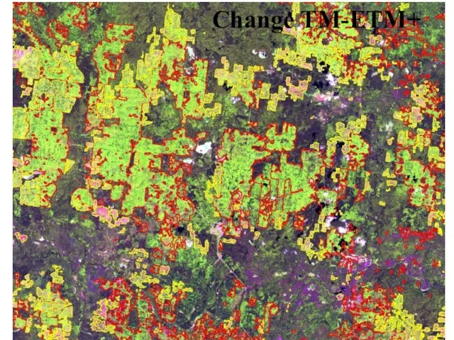
Слайд 14Change TM-ETM+
Change TM-ETM+
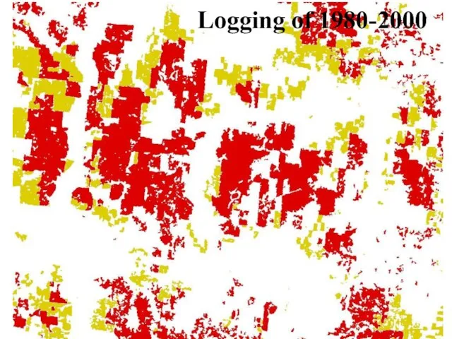
Слайд 15Logging of 1980-2000
Logging of 1980-2000
Слайд 16Productivity / growing stock
is still a problem
NDVI in combination with official data?
Radar
Productivity / growing stock
is still a problem
NDVI in combination with official data?
Radar

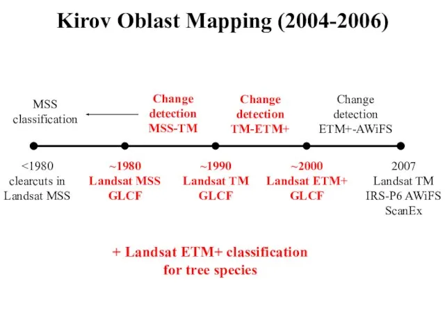
Слайд 18Kirov Oblast Mapping (2004-2006)
~2000
Landsat ETM+
GLCF
~1990
Landsat TM
GLCF
~1980
Landsat MSS
GLCF
2007
Landsat TM
IRS-P6 AWiFS
ScanEx
<1980
clearcuts in
Landsat MSS
Change
detection
MSS-TM
Change
detection
TM-ETM+
Change
detection
ETM+-AWiFS
MSS
classification
+ Landsat
Kirov Oblast Mapping (2004-2006)
~2000
Landsat ETM+
GLCF
~1990
Landsat TM
GLCF
~1980
Landsat MSS
GLCF
2007
Landsat TM
IRS-P6 AWiFS
ScanEx
<1980
clearcuts in
Landsat MSS
Change
detection
MSS-TM
Change
detection
TM-ETM+
Change
detection
ETM+-AWiFS
MSS
classification
+ Landsat
Слайд 19European Russia Mapping (2006-2007)
~2000
Landsat ETM+
GLCF
~1990
Landsat TM
GLCF
~1980
Landsat MSS
GLCF
2006
Modis
<1980
clearcuts in
Landsat MSS
Change
detection
MSS-TM
Change
detection
TM-ETM+
Change
detection
Modis 2001-2006
MSS
classification
+ UMD Treecover
Forest
European Russia Mapping (2006-2007)
~2000
Landsat ETM+
GLCF
~1990
Landsat TM
GLCF
~1980
Landsat MSS
GLCF
2006
Modis
<1980
clearcuts in
Landsat MSS
Change
detection
MSS-TM
Change
detection
TM-ETM+
Change
detection
Modis 2001-2006
MSS
classification
+ UMD Treecover
Forest
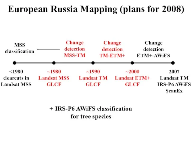
Слайд 20European Russia Mapping (plans for 2008)
~2000
Landsat ETM+
GLCF
~1990
Landsat TM
GLCF
~1980
Landsat MSS
GLCF
2007
Landsat TM
IRS-P6 AWiFS
ScanEx
<1980
clearcuts in
Landsat
European Russia Mapping (plans for 2008)
~2000
Landsat ETM+
GLCF
~1990
Landsat TM
GLCF
~1980
Landsat MSS
GLCF
2007
Landsat TM
IRS-P6 AWiFS
ScanEx
<1980
clearcuts in
Landsat
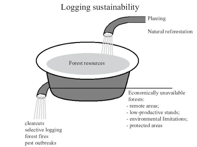
Слайд 21Logging sustainability
Planting
Natural reforestation
clearcuts
selective logging
forest fires
pest outbreaks
Forest resources
Economically unavailable
forests:
remote areas;
low-productive stands;
Logging sustainability
Planting
Natural reforestation
clearcuts
selective logging
forest fires
pest outbreaks
Forest resources
Economically unavailable
forests:
remote areas;
low-productive stands;
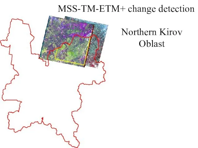
Слайд 22MSS-TM-ETM+ change detection
Northern Kirov Oblast
MSS-TM-ETM+ change detection
Northern Kirov Oblast
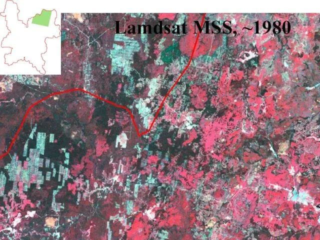
Слайд 23Lamdsat MSS, ~1980
Lamdsat MSS, ~1980
Слайд 24Landsat TM, ~1990
Landsat TM, ~1990
Слайд 25Landsat ETM+, ~2000
Landsat ETM+, ~2000
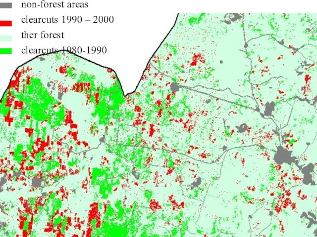
Слайд 26non-forest areas
clearcuts 1990 – 2000
ther forest
clearcuts 1980-1990
non-forest areas
clearcuts 1990 – 2000
ther forest
clearcuts 1980-1990
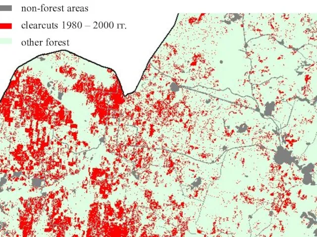
Слайд 27non-forest areas
clearcuts 1980 – 2000 гг.
other forest
non-forest areas
clearcuts 1980 – 2000 гг.
other forest
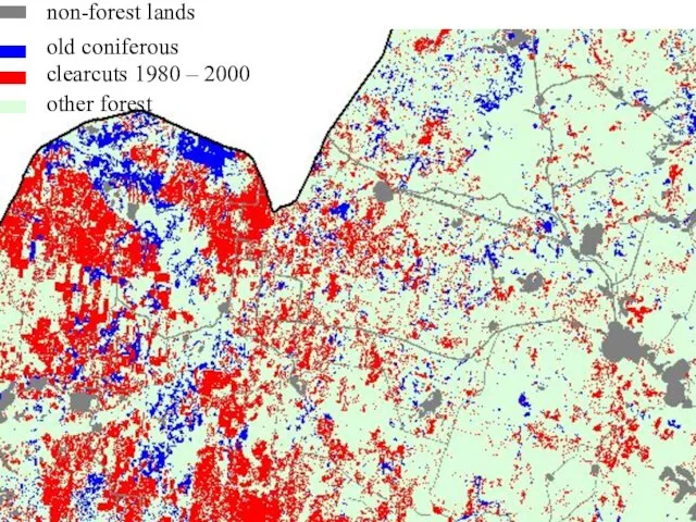
Слайд 28non-forest lands
clearcuts 1980 – 2000
other forest
old coniferous
non-forest lands
clearcuts 1980 – 2000
other forest
old coniferous
 Техника прыжка в длину (согнув ноги)
 Космическое путешествие
 Архитектура ЭВМ и микроархитектура процессора
 Декларация прав и свобод человека и гражданина от 22 ноября 1991 года
 Passive Optical Networks (PON) – проблемы и решения проблем
 Урок развития речи «Моя семья – мое богатство»
 «ОБ ИТОГАХ РАБОТЫ СЛУЖБЫ ЗАНЯТОСТИ НАСЕЛЕНИЯ ПО СНИЖЕНИЮ НАПРЯЖЕННОСТИ НА РЫНКЕ ТРУДА КУРГАНСКОЙ ОБЛАСТИ И ЗАДАЧИ НА ВТОРОЕ ПОЛУГ
 Сухие листья в интерьере
 Өмірлік жұмысқа күш сыйлаймын
 Михаил Евграфович Салтыков-Щедрин
 Больше для Вас…
 Морские гады. Живые морепродуктыпрезентация
 Курсовая работа
 Внедрение коучинг – процесса в начальном и среднем звене
 Презентация на тему История мозаики
 Дифференциация оптически-сходных букв П-Т
 Рыцари и замки
 Globus Intercom. Пассивный доход – всё реально
 Дымковская игрушка
 Релейная защита и автоматика электроэнергетических систем
 Характеристики устройств хранения данных
 Гіперпосилання
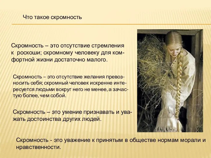 Что такое скромность
 Самостоятельная работа №8. Швейные машины с числовым программным управлением
 Закрытый клуб акционеров социальной ориентации
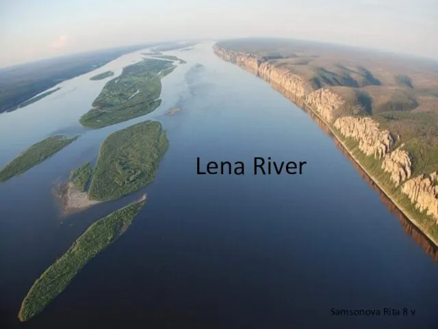 Lena river
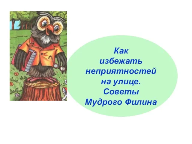 Презентация на тему как избежать неприятностей на улице
  18320_prezentaciya_na_temu_pidpryyemnycka_diyalnist_skachaty