- GIS - презентация к уроку Технологии_

Содержание
- 2. “Project 14.B37.21.1243” WGL-EGL Joint Tech Meeting, September 19-21, 2013 “Research and development of the opened networked
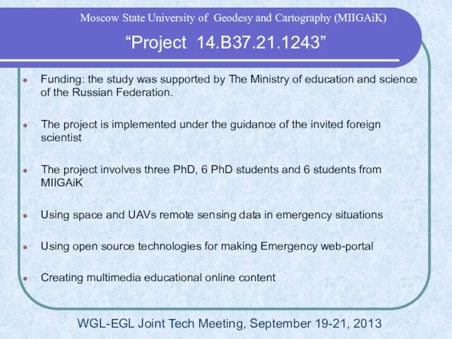
- 3. “Project 14.B37.21.1243” WGL-EGL Joint Tech Meeting, September 19-21, 2013 Moscow State University of Geodesy and Cartography
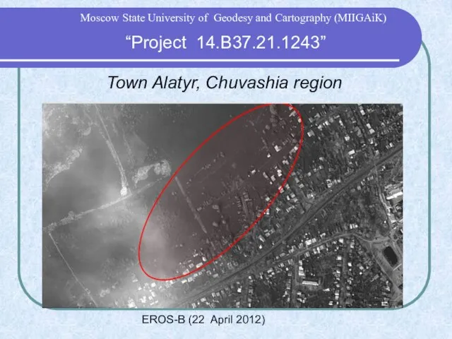
- 4. “Project 14.B37.21.1243” Moscow State University of Geodesy and Cartography (MIIGAiK) Town Alatyr, Chuvashia region Yandex maps
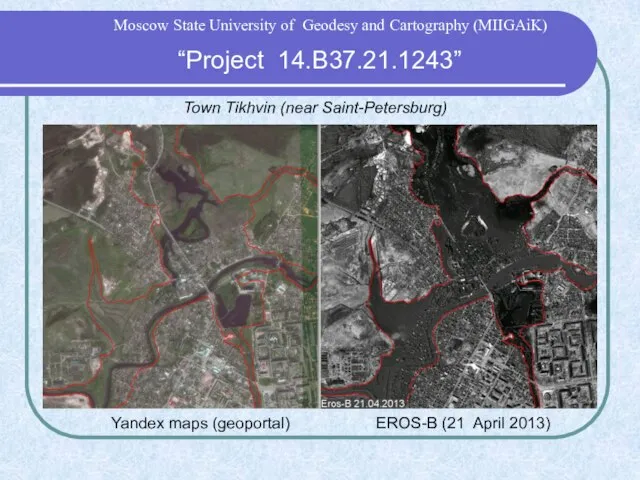
- 5. Town Tikhvin (near Saint-Petersburg) EROS-B (21 April 2013) Yandex maps (geoportal) “Project 14.B37.21.1243” Moscow State University
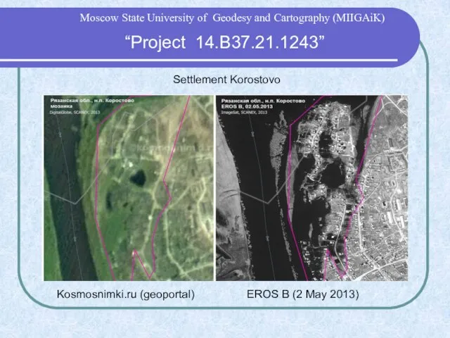
- 6. Settlement Korostovo EROS B (2 May 2013) Kosmosnimki.ru (geoportal) “Project 14.B37.21.1243” Moscow State University of Geodesy
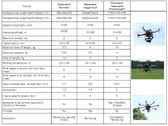
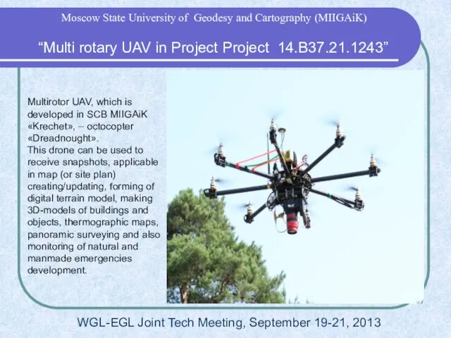
- 7. “Multi rotary UAV in Project 14.B37.21.1243” WGL-EGL Joint Tech Meeting, September 19-21, 2013 Moscow State University
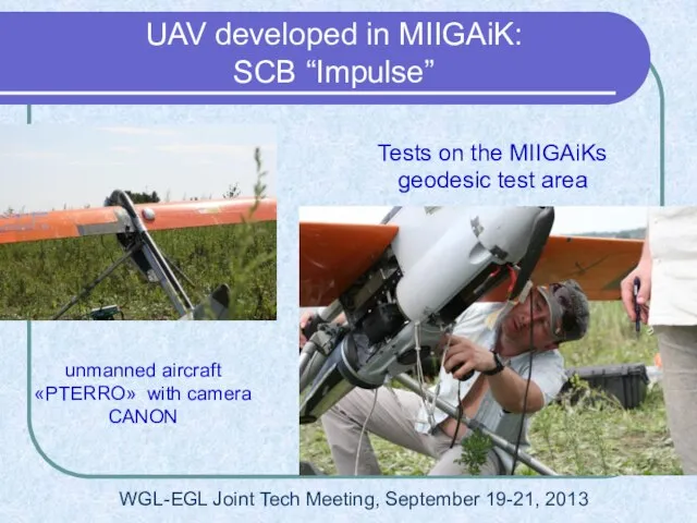
- 8. unmanned aircraft «PTERRO» with camera CANON Tests on the MIIGAiKs geodesic test area UAV developed in
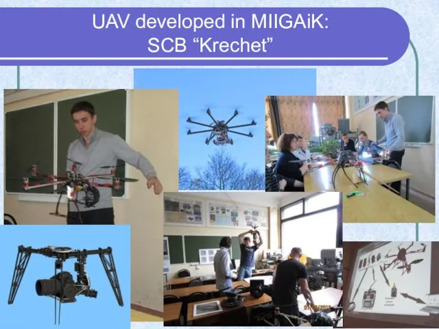
- 9. UAV developed in MIIGAiK: SCB “Krechet”
- 11. Multirotor UAV, which is developed in SCB MIIGAiK «Krechet», – octocopter «Dreadnought». This drone can be
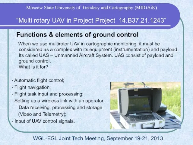
- 12. Functions & elements of ground control When we use multirotor UAV in cartographic monitoring, it must
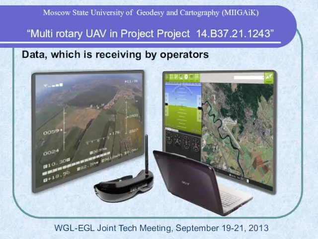
- 13. Data, which is receiving by operators “Multi rotary UAV in Project Project 14.B37.21.1243” Moscow State University
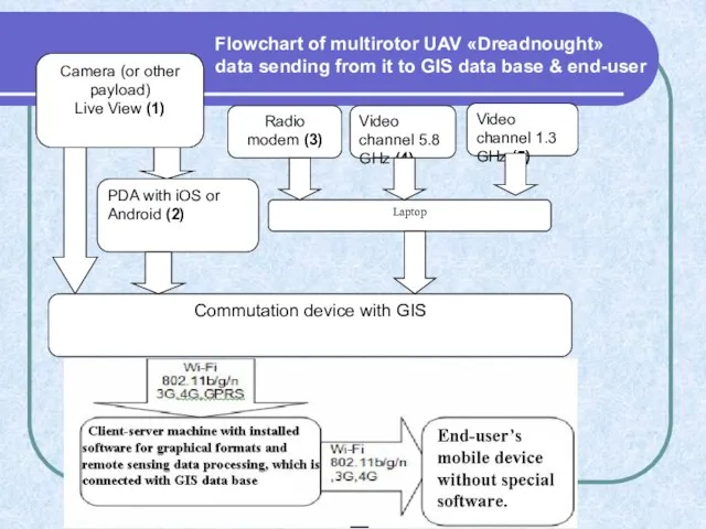
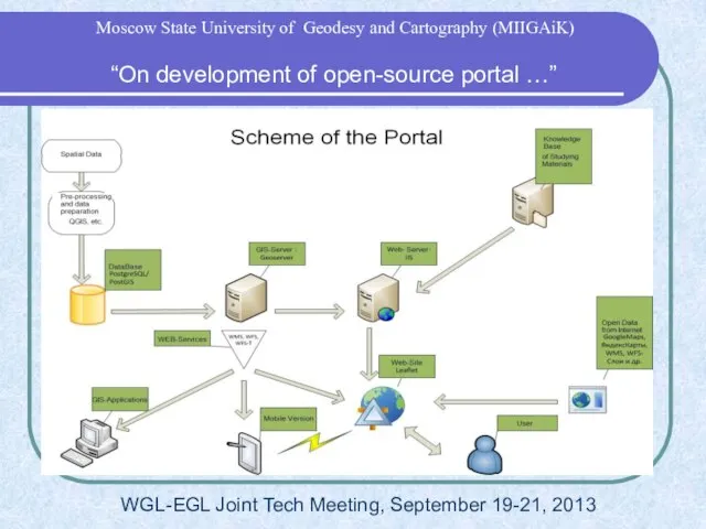
- 14. Flowchart of multirotor UAV «Dreadnought» data sending from it to GIS data base & end-user
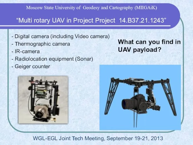
- 15. What can you find in UAV payload? - Digital camera (including Video camera) - Thermographic camera
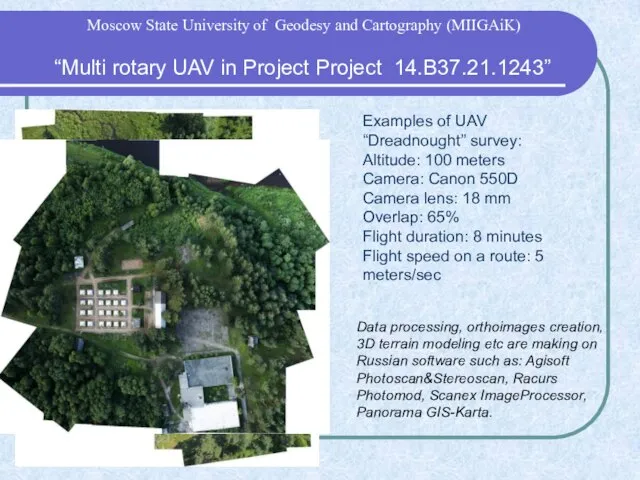
- 16. Examples of UAV “Dreadnought” survey: Altitude: 100 meters Camera: Canon 550D Camera lens: 18 mm Overlap:
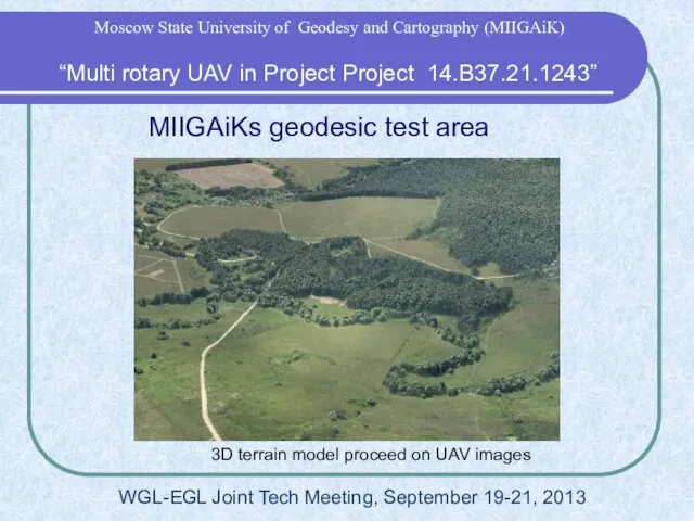
- 17. MIIGAiKs geodesic test area 3D terrain model proceed on UAV images “Multi rotary UAV in Project
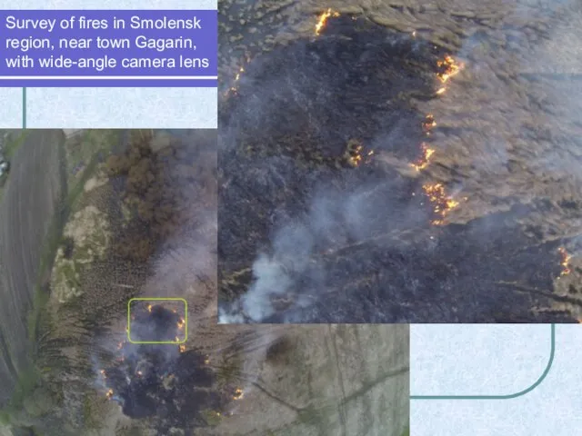
- 18. Survey of fires in Smolensk region, near town Gagarin, with wide-angle camera lens
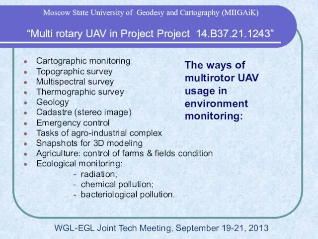
- 19. The ways of multirotor UAV usage in environment monitoring: Cartographic monitoring Topographic survey Multispectral survey Thermographic
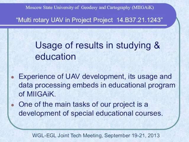
- 20. Usage of results in studying & education Experience of UAV development, its usage and data processing
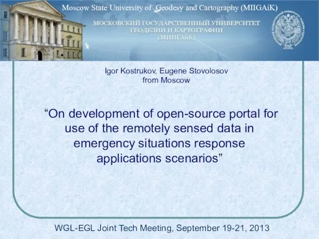
- 21. “On development of open-source portal for use of the remotely sensed data in emergency situations response
- 22. WGL-EGL Joint Tech Meeting, September 19-21, 2013 “On development of open-source portal …” Moscow State University
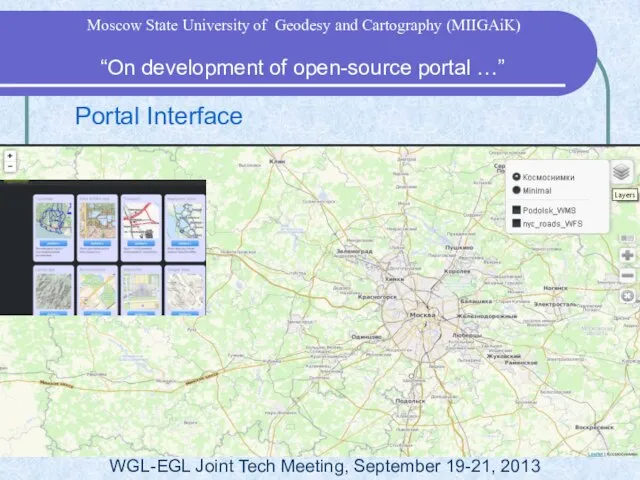
- 23. Portal Interface WGL-EGL Joint Tech Meeting, September 19-21, 2013 “On development of open-source portal …” Moscow
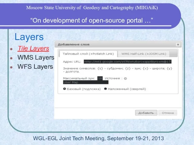
- 24. Layers Tile Layers WMS Layers WFS Layers WGL-EGL Joint Tech Meeting, September 19-21, 2013 “On development
- 25. Layers Tile Layers WMS Layers WFS Layers WGL-EGL Joint Tech Meeting, September 19-21, 2013 “On development
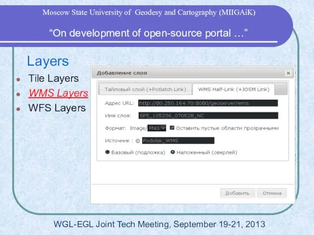
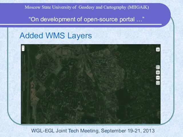
- 26. Added WMS Layers WGL-EGL Joint Tech Meeting, September 19-21, 2013 “On development of open-source portal …”
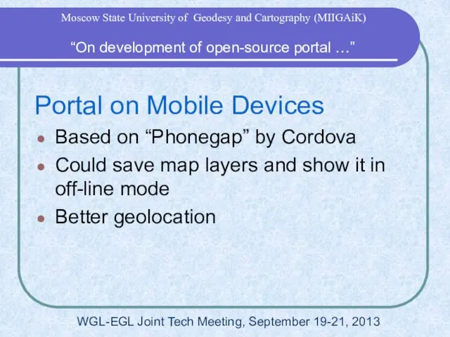
- 27. Portal on Mobile Devices Based on “Phonegap” by Cordova Could save map layers and show it
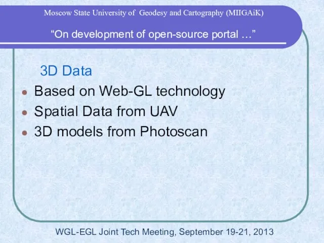
- 28. 3D Data Based on Web-GL technology Spatial Data from UAV 3D models from Photoscan WGL-EGL Joint
- 29. “On development of open-source portal …” Moscow State University of Geodesy and Cartography (MIIGAiK)
- 31. Скачать презентацию
Слайд 2 “Project 14.B37.21.1243”
WGL-EGL Joint Tech Meeting, September 19-21, 2013
“Research and development of
“Project 14.B37.21.1243”
WGL-EGL Joint Tech Meeting, September 19-21, 2013
“Research and development of
Слайд 3 “Project 14.B37.21.1243”
WGL-EGL Joint Tech Meeting, September 19-21, 2013
Moscow State University of
“Project 14.B37.21.1243”
WGL-EGL Joint Tech Meeting, September 19-21, 2013
Moscow State University of
Слайд 4 “Project 14.B37.21.1243”
Moscow State University of Geodesy and Cartography (MIIGAiK)
Town Alatyr, Chuvashia
“Project 14.B37.21.1243”
Moscow State University of Geodesy and Cartography (MIIGAiK)
Town Alatyr, Chuvashia
Слайд 5Town Tikhvin (near Saint-Petersburg)
EROS-B (21 April 2013)
Yandex maps (geoportal)
“Project 14.B37.21.1243”
Moscow
Town Tikhvin (near Saint-Petersburg)
EROS-B (21 April 2013)
Yandex maps (geoportal)
“Project 14.B37.21.1243”
Moscow
Слайд 6Settlement Korostovo
EROS B (2 May 2013)
Kosmosnimki.ru (geoportal)
“Project 14.B37.21.1243”
Moscow State University of
Settlement Korostovo
EROS B (2 May 2013)
Kosmosnimki.ru (geoportal)
“Project 14.B37.21.1243”
Moscow State University of
Слайд 7 “Multi rotary UAV
in Project 14.B37.21.1243”
WGL-EGL Joint Tech Meeting, September 19-21,
“Multi rotary UAV
in Project 14.B37.21.1243”
WGL-EGL Joint Tech Meeting, September 19-21,
Слайд 8unmanned aircraft «PTERRO» with camera CANON
Tests on the MIIGAiKs geodesic test area
UAV
unmanned aircraft «PTERRO» with camera CANON
Tests on the MIIGAiKs geodesic test area
UAV
Слайд 9UAV developed in MIIGAiK:
SCB “Krechet”
UAV developed in MIIGAiK:
SCB “Krechet”
Слайд 11Multirotor UAV, which is developed in SCB MIIGAiK «Krechet», – octocopter «Dreadnought».
This
Multirotor UAV, which is developed in SCB MIIGAiK «Krechet», – octocopter «Dreadnought». This
Слайд 12Functions & elements of ground control
When we use multirotor UAV in
Functions & elements of ground control
When we use multirotor UAV in
Слайд 13Data, which is receiving by operators
“Multi rotary UAV in Project Project
Data, which is receiving by operators
“Multi rotary UAV in Project Project
Слайд 14Flowchart of multirotor UAV «Dreadnought»
data sending from it to GIS data
Flowchart of multirotor UAV «Dreadnought» data sending from it to GIS data
Слайд 15What can you find in UAV payload?
- Digital camera (including Video camera)
-
What can you find in UAV payload?
- Digital camera (including Video camera)
-
Слайд 16Examples of UAV “Dreadnought” survey:
Altitude: 100 meters
Camera: Canon 550D
Camera lens: 18 mm
Overlap:
Examples of UAV “Dreadnought” survey: Altitude: 100 meters Camera: Canon 550D Camera lens: 18 mm Overlap:
Слайд 17MIIGAiKs geodesic test area
3D terrain model proceed on UAV images
“Multi rotary
MIIGAiKs geodesic test area
3D terrain model proceed on UAV images
“Multi rotary
Слайд 18Survey of fires in Smolensk region, near town Gagarin,
with wide-angle camera
Survey of fires in Smolensk region, near town Gagarin, with wide-angle camera
Слайд 19The ways of multirotor UAV usage in environment monitoring:
Cartographic monitoring
Topographic survey
Multispectral survey
Thermographic
The ways of multirotor UAV usage in environment monitoring:
Cartographic monitoring
Topographic survey
Multispectral survey
Thermographic
Слайд 20Usage of results in studying & education
Experience of UAV development, its usage
Usage of results in studying & education
Experience of UAV development, its usage
Слайд 21 “On development of open-source portal for use of the remotely sensed
“On development of open-source portal for use of the remotely sensed
Слайд 22WGL-EGL Joint Tech Meeting, September 19-21, 2013
“On development of open-source portal
WGL-EGL Joint Tech Meeting, September 19-21, 2013
“On development of open-source portal
Слайд 23 Portal Interface
WGL-EGL Joint Tech Meeting, September 19-21, 2013
“On development of
Portal Interface
WGL-EGL Joint Tech Meeting, September 19-21, 2013
“On development of
Слайд 24 Layers
Tile Layers
WMS Layers
WFS Layers
WGL-EGL Joint Tech Meeting, September 19-21, 2013
“On
Layers
Tile Layers
WMS Layers
WFS Layers
WGL-EGL Joint Tech Meeting, September 19-21, 2013
“On
Слайд 25 Layers
Tile Layers
WMS Layers
WFS Layers
WGL-EGL Joint Tech Meeting, September 19-21, 2013
“On
Layers
Tile Layers
WMS Layers
WFS Layers
WGL-EGL Joint Tech Meeting, September 19-21, 2013
“On
Слайд 26 Added WMS Layers
WGL-EGL Joint Tech Meeting, September 19-21, 2013
“On development
Added WMS Layers
WGL-EGL Joint Tech Meeting, September 19-21, 2013
“On development
Слайд 27Portal on Mobile Devices
Based on “Phonegap” by Cordova
Could save map layers and
Portal on Mobile Devices
Based on “Phonegap” by Cordova
Could save map layers and
Слайд 28 3D Data
Based on Web-GL technology
Spatial Data from UAV
3D models from Photoscan
WGL-EGL
3D Data
Based on Web-GL technology
Spatial Data from UAV
3D models from Photoscan
WGL-EGL
Слайд 29 “On development of open-source portal …”
Moscow State University of Geodesy and
“On development of open-source portal …”
Moscow State University of Geodesy and
 Презентация на тему Резьба по дереву
  Серебряный браслет
 Презентация на тему Обрывная аппликация из бумаги на бумажной основе
  Презентация на тему Сварочные трансформаторы
 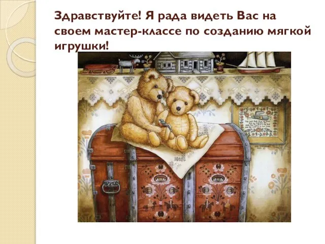 Презентация на тему Мастер - классе по созданию мягкой игрушки
  Презентация на тему Батик
  Вязание на спицах 4 класс - презентация_
 Творческий отчет Салат «Нежный эксклюзив»
 Презентация на тему: Пояс, сплетённый из лент
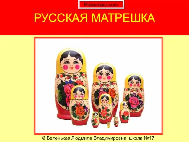 Презентация на тему Русская игрушка - Матрешка
 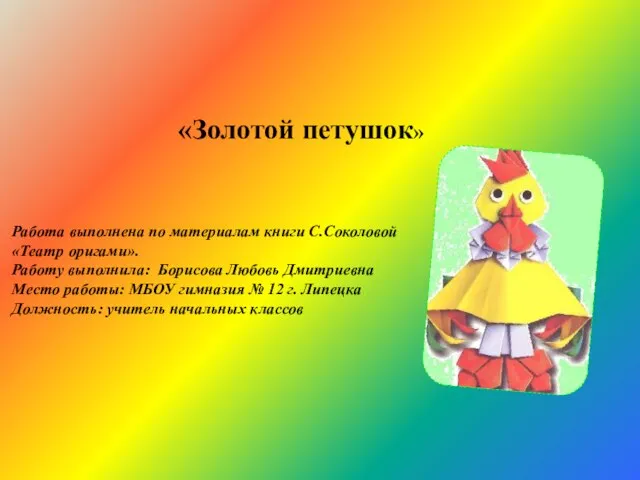 Золотой петушок - презентация к уроку Технологии_
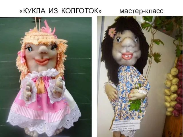 Презентация на тему Куклы из колготок
 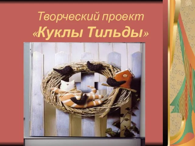 Творческий проект «Куклы Тильды»
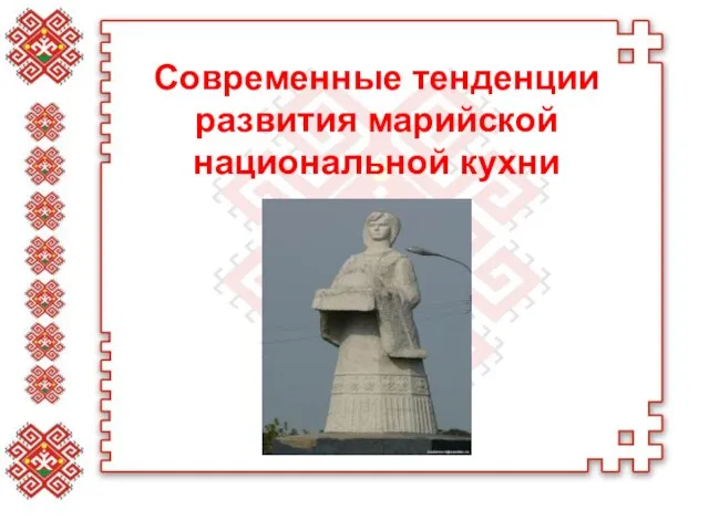 Современные тенденции развития марийской национальной кухни - презентация к уроку Технологии
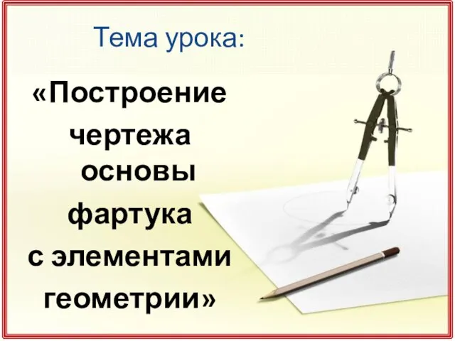 Построение чертежа основы фартука с элементами геометрии - презентация к уроку Технологии_
 Презентация на тему Нарезание наружной и внутренней резьбы
  Занятия аппликацией как средство развития творчества детей Аппликация - наиболее простой и доступный способ создания художестве
 Оформление интерьера квартиры миниатюрами с вышивкой - презентация к уроку Технологии_
 Презентация на тему: Магия металла: Плетение из проволоки
 Презентация на тему Щепа. Роспись по лубу и дереву
  Розовый птенчик - презентация к уроку Технологии_
 Презентация на тему Сервировка праздничного стола
  муниципальное бюджетное общеобразовательное учреждение «Средняя общеобразовательная школа №4 п. Тавричанка Надеждинского район
 Плетёные листья
 Презентация на тему: Домашняя Масленица
 Презентация на тему Гигиена кожи, одежды и обуви
  Натуральные волокна. Хлопок. Урок технологии (швейное дело) 5 класс для учащихся СКОШ VIII вида Учитель технологии: Авдонина Елена
 Презентация на тему Современное декоративное искусство. Сухая аппликация