Слайд 2Rivers in New Zealand feed on either rainfall or snowmelt. Often the
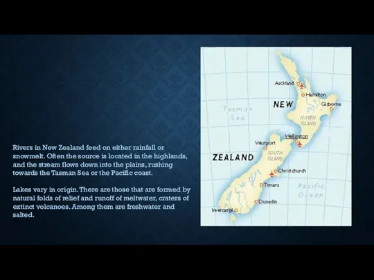
source is located in the highlands, and the stream flows down into the plains, rushing towards the Tasman Sea or the Pacific coast.
Lakes vary in origin. There are those that are formed by natural folds of relief and runoff of meltwater, craters of extinct volcanoes. Among them are freshwater and salted.
Слайд 3Large rivers of New Zealand
The number of rivers on the islands is
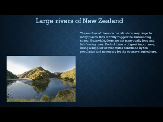
very large. In many places, they literally rugged the surrounding space. Meanwhile, there are not many really long and full-flowing ones. Each of them is of great importance, being a supplier of fresh water consumed by the population and necessary for the country's agriculture.
Слайд 4Waikato river
The longest river in New Zealand is 425 km long. The
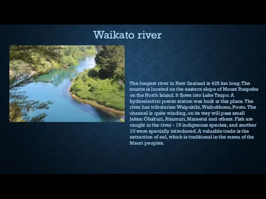
source is located on the eastern slope of Mount Ruapehu on the North Island. It flows into Lake Taupo. A hydroelectric power station was built at this place. The river has tributaries: Waipakihi, Waihokhonu, Pouto. The channel is quite winding, on its way will pass small lakes: Ohakuri, Atiamuri, Maraetai and others. Fish are caught in the river - 19 indigenous species, and another 10 were specially introduced. A valuable trade is the extraction of eel, which is traditional in the menu of the Maori peoples.
Слайд 5Kluta River
The second largest river in the country is located on the
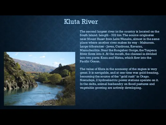
South Island. Length - 322 km. The source originates near Mount Haast from Lake Wanaka, almost in the same place where another river makes its way - Makarora. Large tributaries - Javea, Cardrona, Kavarau, Manucherikia. Near the Rongaher Gorge, the Tuapeca River flows into it. At the mouth, the channel is divided into two parts: Koau and Matau, which flow into the Pacific Ocean.
The value of Kluta in the economy of the region is very great. It is navigable, and at one time was gold-bearing, becoming the source of the "gold rush" in Otago. Nowadays, 2 hydroelectric power stations operate on it. In the delta, animal husbandry on flood pastures and vegetable growing are actively developing.
Слайд 6Wanganui River
The third largest river in the country flows in a southeast
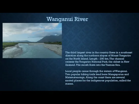
direction along the northern slopes of Mount Tongariro on the North Island. Length - 290 km. The channel crosses the Tongariro National Park, the oldest in New Zealand. The mouth flows into the Tasman Sea.
Local people canoe through the waters of Wanganui. Two popular hiking trails lead here: Mangapurua and Matemateaonga. Along the coast there are several sacred places for the indigenous population, called the marae.
Слайд 7Taieri River
The fourth largest river in the country flows through the South
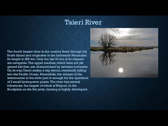
Island and originates in the Lammerlo Mountains. Its length is 288 km. Only the last 20 km of its channel are navigable. The upper reaches, which have not yet gained full flow, are characterized by extreme tortuosity. On its way, Taieri makes a big detour, eventually falling into the Pacific Ocean. Meanwhile, the volume of the watercourse in the wide part is enough for the operation of 2 small hydropower plants. The river has several tributaries, the largest of which is Waipori. In the floodplain on the flat plots, farming is highly developed.
Слайд 8Large Lakes of New Zealand
The country is famous for a huge number
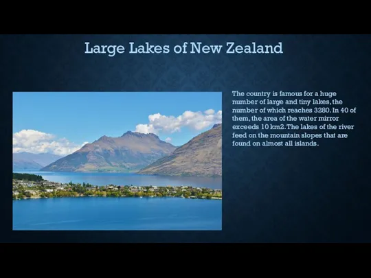
of large and tiny lakes, the number of which reaches 3280. In 40 of them, the area of the water mirror exceeds 10 km2. The lakes of the river feed on the mountain slopes that are found on almost all islands.
Слайд 9Taupo Lake
The largest in area - its mirror is 616 km2. Water
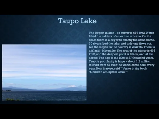
filled the caldera of an extinct volcano. On the shore there is a city with exactly the same name. 30 rivers feed the lake, and only one flows out, but the largest in the country is Waikato. There is a island - Motutaiko. The area of the mirror is 616 km2, and the deepest point is 164 m, and 44 km across. The age of the lake is 27 thousand years. Taupo’s popularity is huge - about 1.2 million tourists from all over the world come here every year. How it arose, said J. Verne in the book "Children of Captain Grant."
Слайд 10Lake Te Anau
From the original Maori language, the name of the lake
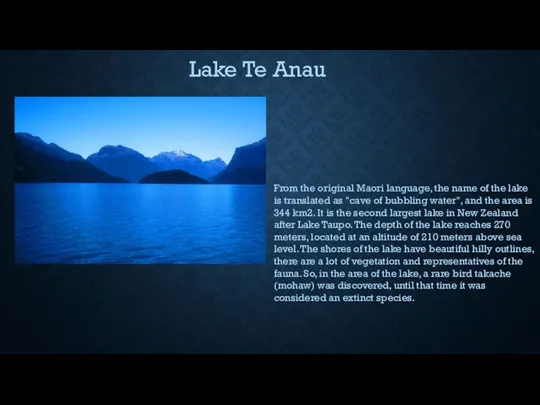
is translated as "cave of bubbling water", and the area is 344 km2. It is the second largest lake in New Zealand after Lake Taupo. The depth of the lake reaches 270 meters, located at an altitude of 210 meters above sea level. The shores of the lake have beautiful hilly outlines, there are a lot of vegetation and representatives of the fauna. So, in the area of the lake, a rare bird takache (mohaw) was discovered, until that time it was considered an extinct species.
Слайд 11Wakatipu Lake
This, if not the largest, then the longest lake in New
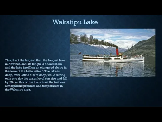
Zealand. Its length is about 80 km and the lake itself has an elongated shape in the form of the Latin letter S. The lake is deep, from 230 to 420 m deep, while during only one day the water level can rise and fall by 20 cm, this is due to contrast fluctuations atmospheric pressure and temperature in the Wakatipu area.
Слайд 12Waikaremoana Lake
The deepest in the country - the bottom is lowered to
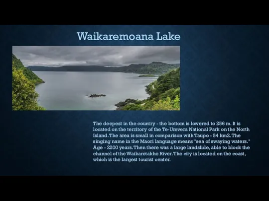
256 m. It is located on the territory of the Te-Urevera National Park on the North Island. The area is small in comparison with Taupo - 54 km2. The singing name in the Maori language means "sea of swaying waters." Age - 2200 years. Then there was a large landslide, able to block the channel of the Waikaretakhe River. The city is located on the coast, which is the largest tourist center.
Слайд 13Branner Lake
Glacial lake of ancient origin from glacial waters. The area of
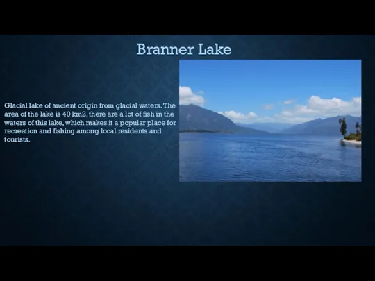
the lake is 40 km2, there are a lot of fish in the waters of this lake, which makes it a popular place for recreation and fishing among local residents and tourists.

 Трудовые ресурсы и трудовой потенциал общества
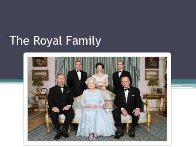 The Royal Family Queen Elizabeth II
 Виды деятельности бизнес-инкубатора университета
 Факультет дошкольной и коррекционной педагогики и психологии
 Изображение гражданской войны в «Донских рассказах» М.А.Шолохова
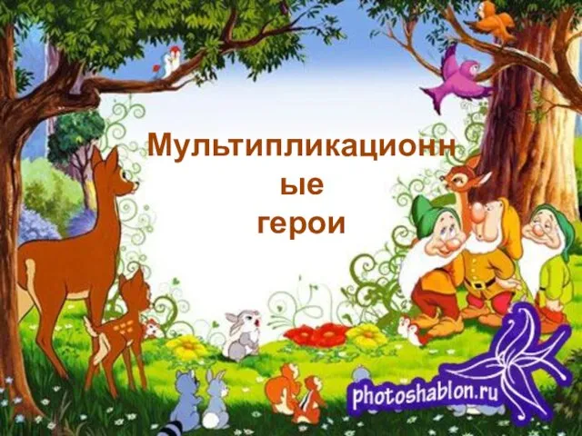 Мультипликационные герои
 Самая красивая
 Добро пожаловать!
 Мешочек для хранения работ
 Марафон Intant Culture Code
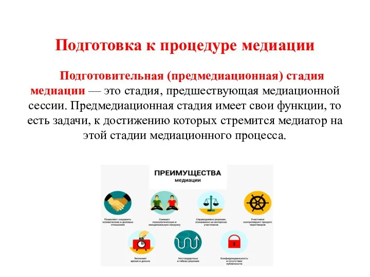 Подготовка к процедуре медиации
 Методы исследования в менеджменте ГК Навигатор
 Открытый урок химии по теме «Глюкоза»
 Топологическая оптимизация
 Кто хочет стать отличником по физике?
 Своя игра. Математика
 ПОРТФОЛИО ДЕТЕЙ дошкольного возраста
 الإدمان على الانترنت لغة عربية صف ثامن فصل أول
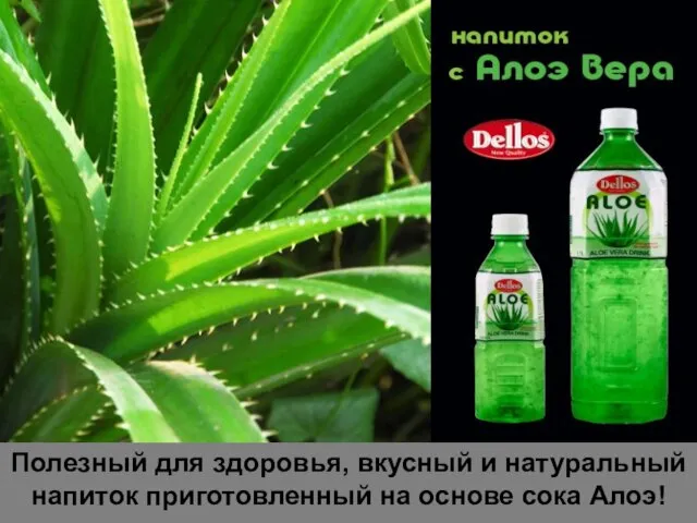 Полезный для здоровья, вкусный и натуральный напиток приготовленный на основе сока Алоэ!
 «Нет ничего более легкого, чем быть занятым, и нет ничего более трудного, чем быть результативным» Ален Маккензи
 Базирование Техосн (1)
 Черты раннего сентиментализма в портретах Ф.С. Рокотова
 бирки на пластилин
 Корригирующие упражнения на физкультурных занятиях
 Курсы Дистанционного Обучения
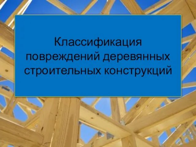 Классификация повреждений деревянных строительных конструкций
 Методическая служба учреждений дополнительного образования. Тема 4
 Игровые технологии