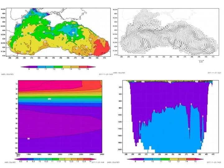
resolution: 33 vertical levels ( various discretization schemes)
Model domain:
Lat : from 41 to 46.7 °N ; Long: from 28 to 42 °E
Bathymetry: ETOPO 5’ slightly smoothed / corrected
Forcing:
6h re-analysis data ( 8 parameters): Wind (U,V), SL pressure, SL air temperature, SL specific humidity, precipitation, Long wave radiation, Short wave radiation
[sources: NCEP, (low-res), DFS5.2 (low-res), SKIRION (high res)]
Lateral boundaries: rivers and Bosphorous (in-out),
monthly data
NEMO: 3-D, Baroclinic, hydrostatic, Arakawa C grid.
VERTICAL GRIDS
Standard vertical grids in NEMO:
z-level (a) ,
sigma/s-level (b) ,
z-on-top-of-sigma (c)


 Современный сленг
 Построение трехмерной сцены и визуализация погодных эффектов в городском ландшафте
 Цель ведения аккаунта
 Waarom Array?
 Системные вызовы и адресация
 Математическое моделирование семейств псевдослучайных последовательностей
 Информационная безопасность
 Исследование прохождения амплитудно-модулированного колебания через колебательный контур. Лабораторная работа 3
 Переменные и функции
 Компьютерная игра Управление развитием территории
 Системы счисления. Математические основы информатики
 1_2_1
1_2_1 Какая бывает информация
 Инсталляция и эксплуатация вычислительных машин и систем
 Мастер-класс по созданию маски в instagram
 Таблицы истинности
 Проникновение и деятельность вируса Spora на ПК
 Преобразователи форматов
 Новая форма регистрации
 Обучение. Локальные турниры CyberX
 Работа с Интернет магазином, Интернет - СМИ, Интернет - библиотекой
 Системный интегратор автоматизированных систем управления технологических процессов
 Массивы. Основные понятия
 Разработка Бота-Помощника на базе языка программирования C#
 Содержательный подход и вероятность
 Лекция 29. CorelDRAW Инструменты группы. Изменение формы
 Вставьте ваш текст
 Преимущества перехода на ЮЗЭДО